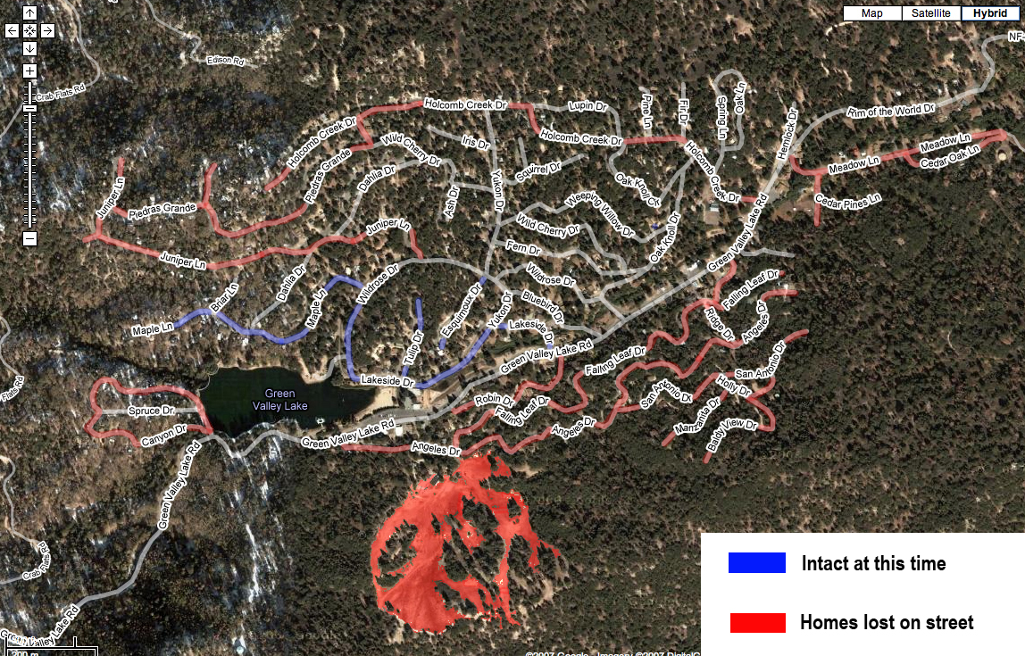
Home  |  Contact Us  |  Read Comments  Special Thanks  Donate  About Us           


 Burn Maps


  Witch Fire – 197,990 acres – 45% contained    Witch Fire Map 10/26/07
Harris Fire – 84,300 acres – 20% contained   
Harris Fire Map 10/26/07
Poomacha Fire – 39,000 acres – 35% contained   
Poomacha Fire Map 10/26/07
Rice Fire – 9,000 acres – 40% contained    
Rice Fire Map 10/26/07
Horno/Ammo Fire – 19,353 acres – 80% contained    
Horno/Ammo Fire Map 10/26/07
Santiago Fire – 27,000 acres – 30% contained   
Santiago Fire Map 10/26/07
Ranch Fire – 58,396 acres – 87% contained
Slide Fire – 13,378 acres – 15% contained   
Slide Fire Map 10/26/07
Grass Valley Fire - 1,100 acres – 70% contained  
Grass Valley Fire Map 10/26/07


View Larger Map


2003 OLD FIRE COMPARED WITH 2007 SLIDE FIRE


TWIN PEAKS

 
View Larger Map


HARRIS FIRE

WITCH FIRE

NW SAN DIEGO FIRES

CLOSE UP OF WEST SIDE OF WITCH FIRE


GREEN VALLEY LAKE

Here's a map that someone put together of the Green Valley Lake area.
 The acuracy of the map could be 100% or completely wrong in every way. 
Maybe it's not even GVL.  Maybe it just looks like GVL and is actually
a lake in Billings Montana.  I don't know. But here's the map:


BUCKWEED FIRE


WITCH FIRE


RANCHO SANTA FE BURN ZONE


RANCHO BERNARDO BURN ZONE


CANYON FIRE


About Us  |  Contact Us


Hit Counter


Other Sites by Dacy Nottingham