|
|
|
|

Ranger Al Exclusive
(for those familiar with the area)
This is not gathered on the
Internet. Rumors can spread quickly that way. This is Bases on Ranger Al
Personal experiences.
Cedar
Pines Park | Valley of
Enchantment |
Playground/TopTown | Skyland |
Rim Forest | Blue Jay
| Twin Peaks
North Shore |
Grass Valley | Arrowhead Villas
| Crest Park |
Arrowhead Village |
Cedar Glen |
Running Springs
Arrowbear |
Green Valley Lake | Big Bear |
Waterman Canyon
|
|
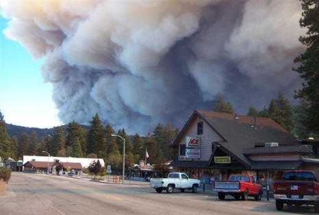
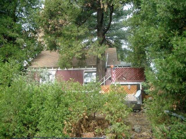
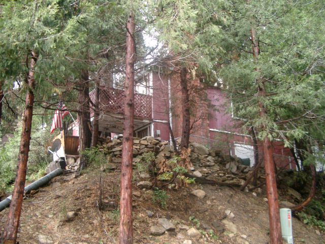
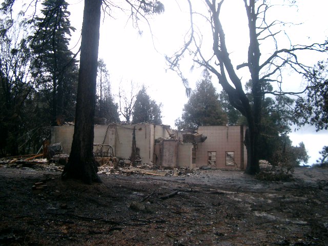
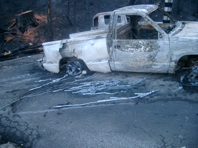
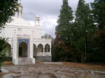
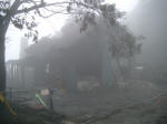
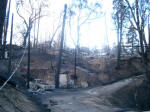
Photo by John T Mcintosh - Crestline on 10/28/03
|
|
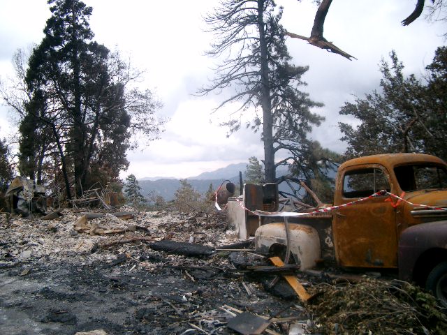
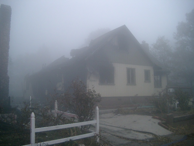
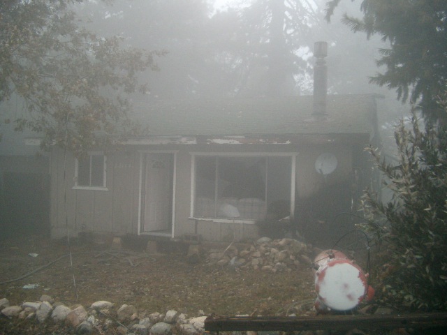
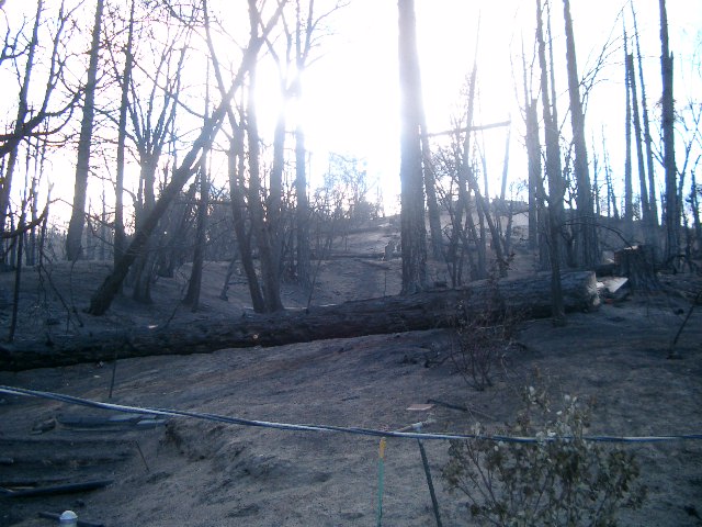
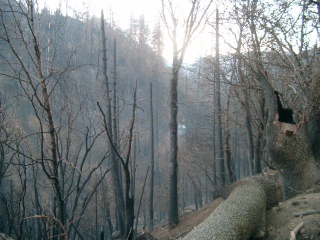
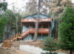
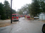
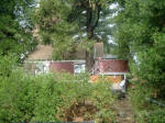
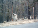
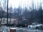
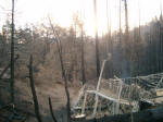
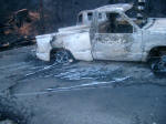
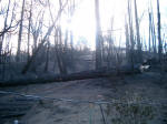
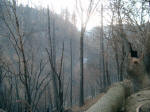
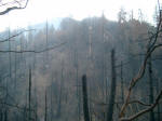
Cedar Pines Park
Pictures taken of the burn area on
11/1/03


|
| |
Burned
|
Not Burned |
|
Peak Circle |
3 houses between 21411 and 21543
GPS 34° 15.34'N 117° 19.78'W
1 house across from those 3 (maybe 2144?) |
21411
21543 |
|
|
|
|
|
Jobs Peak Rd |
|
All OK |
|
|
|
|
|
Hartman Cir |
|
All OK |
|
|
|
|
|
Sawpit |
Big White House that was in the
movie "The Hand" |
21111 |
|
|
|
|
|
Sawpit Canyon Spur |
|
386
470 |
|
|
|
|
|
Cedar Lake Dr |
House on Corner |
319 |
|
|
|
|
|
Axcension Ct |
|
525 |
|
|
|
|
|
Alder Glen Dr |
431 |
468 |
|
|
|
|
|
Monument Peak |
|
190 |
|
|
|
|
|
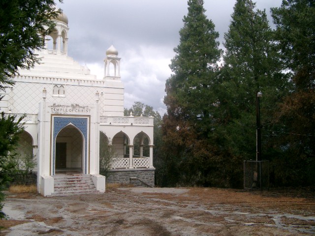
Mozumdar |
729
Houses between 729-829
In between 729 and Sand hill
757
765
803
Temple outbuildings |
No homes were burned before the
729 address
829
737
841
In between 737&729
Temple
|
|
Sandhill |
743 and home across street
745 |
1 house |
| |
| |
| |
|
|
|
Valley of Enchantment
Back to top |
No burns
|
Lake Gregory Area
Back to top |
No burns
|
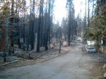
Playground / Top town
Back to top
Pictures taken of the burn area on
11/1/03
76
77
78
79 |
| |
Burned
|
Not Burned |
|
Playground Dr |
none |
All OK from the fronts of the
homes. Some reports that there could be some damage in
the backs of a couple homes. |
|
|
|
|
|
Grandview |
none |
All OK |
|
|
|
|
|
Summit |
none |
All OK |
|
|
|
|
|
Valley View |
22664- Pic 78
22680 Heavy Damage Pic 76
Homes between 22664-22680
22671 Pic 77
22677
22664 damaged
226?? (across from 22664)-Pic 79
2 model A's in Garage
|
22661 |
| |
| |
| |
| |
| |
|
|
| |
|
|
|
Skyland
Back to top
|
GPS of burn area on
saturn-neptune- 34° 13.91 N, 117°16.99 W, 34° 18.83 N, 117°17.02 W,
34° 13.86 N, 117°17.10 W
| |
Burned
|
Not Burned |
|
Neptune |
All houses on dead end section
1147
1156
|
Green house- couldn't see
address |
|
Saturn |
1188 - Ford Van burned in front
1185 and house across from it
1197
1194
1188
1166
1178 -marked private road
|
1141 Might be on Skyland
1158 might be on Jupiter (Grey with red trim) |
|
Jupiter |
looks fine |
|
|
Rockview |
4 houses east of 24127 (3rd
house garage ok, house burned- tan)
24169 |
24127
24187 |
|
Greatview Dr |
24347 next to green water tank
1 house west of 243471
house West of 24571 right at intersection of Greatview Ln |
24381
24365
Everything east of 24381 to the dead end except for the one
listed on the intersection |
|
Greatview Ln |
|
24583
24653
24571
24613
24625 |
|
Crest Forest |
24719 - house ok 15 of 30cars
destroyed 24737
|
24757 |
|
Ocean View |
2 houses east of 25008
house across street from 25008
house across street from 24988
1 house east of 24929
West end of Ocean View and Crest Forest Drive (corvette in
driveway)
|
25008
24988
24929
Other homes in area |
| |
|
|
|
|
Rim Forest
Back to top
|
| |
Burned
|
Not Burned |
|
Hwy 18 |
26262
26272
26276
26288
there may be another house in that area. Its hard to pick out the
houses in the rubble.
Cable Business
Alpine and
Trust Businesses Small part of the lumber yard. |
|
| |
|
|
|
Blue Jay
Back to top
|
Blue Jay and Agua Fria is Safe.
Reports that Jensen's or the Ice Rink burned are false. |
Twin Peaks
Back to top
|
| |
Burned
|
Not Burned |
|
Hwy 189 |
25706 |
|
It looks like a whole
separate fire. There is not any other homes or even forest burned near it.
The rest of Twin Peaks looks fine. Must be just a freak accident.
|
North Shore
Back to top |
The North Shore, North of the Dam is
safe. The fire threatened the hospital but didn't burn any
structures west of there. There was a small flare up in the
area on Friday night. No damage.
|
Grass Valley
Back to top |
The Country Club area and other parts of
the Grass Valley area are safe and had no burned structures.
|
Arrowhead Villas
Back to top |
Arrowhead Villas. We traveled down Arrowhead
Villa Rd, Around all the side streets and up and down Kuffel Canyon. No
homes burned.
|
Crest Park
Back to top |
South of 18 West
of 173 Near the Park/Campground GPS 34° 13.74 N 117° 12.12 W
| |
Burned
|
Not Burned |
|
Road could be called Lower Crest
Dr? |
All homes on the east side (even
number addresses) Cant pick out addresses
24812 |
Marked 84 "harts"
Yellow house (now red due to flame retardant) Marked
"Desire"
27813 |
| |
|
|
|
Arrowhead Village
Back to top |
The Arrowhead Village Area is fine. |
|
Cedar Glen
Back to top
29647 Hook Creek
29667 Hook Creek
Looking up alder from Bridge Rd. Jade looks similar All
gone
Top of Loop Dr looking S
Top of Loop Dr looking E
Top of Loop Dr
Top of Loop Dr looking W
Top of Loop Dr looking N
End of hook cr >SW
End of Hook Creek >SE
|
For this area I am
listing only areas that are Not Burned!
| |
|
Not Burned |
|
Drove up Lakeview up and around
the loop |
Every house OK |
| |
|
|
Lilac |
Everything before and including
266 & 265 and a chevy van that hasn't moved in a long time
in front of a burned out house. |
| |
|
|
Balsam |
240 Z Car is OK (4jxw036) in
front of a burnt house
213
179 Fern Ln
Homes closer to Glen Avon, I'll be more detailed later. |
| |
|
|
Lupin |
4 houses gone |
| |
|
|
Glen Avon |
Homes have burned. These
are 300,284,289,261,269,299,281,253
This information has been
verified by Ranger Al. |
| |
|
|
Craghill Dr. Long North/South
Part |
Every house OK |
| |
|
|
Craghill Dr. Windy Part |
Road closed. trees down
looks burnt up the road |
| |
|
|
Maple |
522 |
|
|
|
|
Lake Brook/Hemlock Area |
Every house OK |
| |
|
|
Pine Dr - until pavement
ends |
Every house OK |
| |
|
|
Drove in Hook Creek Last good
house was 29624. First burnt home was at
34° 15.21 N, 117° 9.42 W.
Everything to the East is burned as far as we could see from
Pine ridge |
Hook Creek
29388 confirmed gone |
29686
29682
29676
29656.
29400 ok but trailer gone
Mule ranch ok, but 1st building on left as you approach it
is gone
29580
29599
Big grey house near 29656 |
|
|
|
Alder |
299
Green Van OK in front of burned 296 |
|
|
|
|
Turned onto Pine ridge |
Everything Gone up to Acacia |
| |
|
|
Turned onto Acacia |
524
White Oldsmobile (4chn553) |
| |
|
|
Little bear (I think) |
29643 yellow
29637 red
Mecedes OK (4bhf441) |
| |
|
|
Little bear circle |
29543 and the house across from
it
29542 |
| |
|
|
Elder |
563
560
601
One house west of 601 |
| |
|
|
Box Dr. |
Last house on street stands.
1 of 5 cars survived GPS-
34° 15.71 N,
117° 9.39 W. |
| |
|
|
Cypress |
Gold Jeep Cherokee (4JYB634)
sitting unburned in a driveway of a burnt house.
Everything else burned. |
| |
|
|

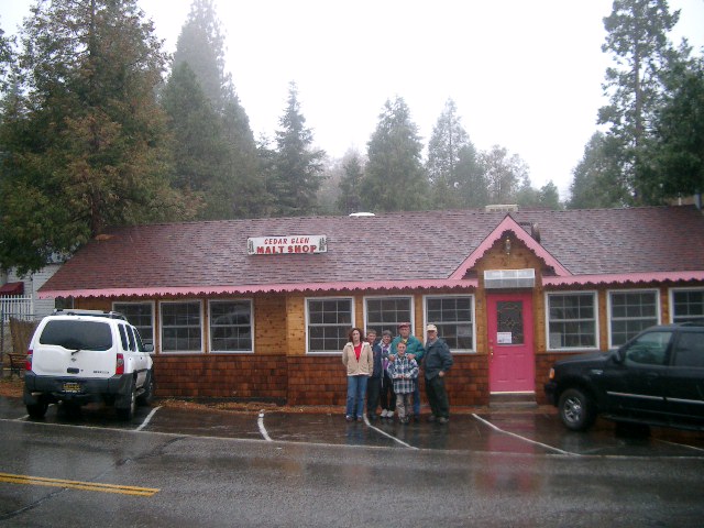
Ranger Al stands with the
owners of The Malt Shop
|
Running Springs
Back to top |
Appears to be no damage at this point.
Fire continues to burn in about a mile south of Running Spring.
|
Arrowbear
Back to top |
Appears to be no damage at this point.
The fire is coming toward Arrowbear slowly from the Running Springs
area. The weather hopefully will make it slow down so the
firemen can stomp it out.
|
Green Valley Lake
Back to top |
Appears to be no damage at this point
|
Big Bear
Back to top |
Firefighters have made fire breaks to
keep the fire from getting too close. |
Waterman Canyon
Back to top |
Only the Fire Station and 8 residences
remain above the highway of approximately 50 that were there.
Addresses of those homes will be posted as soon we can, please do
not ask. I will post them when I have them. |
|
|
|
|
For informational
purposes only. Not responsible for any errors or omissions.
|
|
|
|